| Kefalonia - Cephalonia |
 |
 |
This description provides information of ancient sites, seaside resorts, churches, monasteries, landscapes and small towns and villages. Additional details can be found in various books printed on Greece, such as the 'Blue Guide to Greece.' The names of places conform to the accented Greek pronounciation which would be the one a traveller would face upon a potential visit.
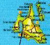
For a general map of the Ioanian islands, click here!. For a map of Kefalonia area, click here.
To go back to the Ionian islands main page, click here!
Kefalonia - Cephalonia
 |
Also called CEPHALONIA, Modern Greek KEFALLON�A, (pop. 27,649 in1981), largest of the Ionian Islands, west of the Gulf of Patra�k�s. With the island of Ithaca (Ith�ki) and smaller nearby islands, it forms the nom�s (prefecture or department) of Kefallin�a in modern Greece.
|
The island, 302 square miles (781 square km) in area, is mountainous, with Mount A�nos (ancient Mount Aenos; 5,341 feet [1,628 m]) often snowcapped for months. Except for the Raki, there are few permanent streams, and springs can fail in the summer. In the west a gulf penetrates the island from the south; on its east side is the capital and port of Argost�lion (q.v.), on its west side is the town of Lixo�rion. Agriculture is limited; currants are the chief export, but olives, grapes, grain, and cotton are also grown. Cephallenia's manufactures include lace, carpets, wine, and boats.
The island was an important Mycenaean centre and was probably the island known to Homer as Same. In the Peloponnesian War it sided with Athens and later was a member of the Aetolian League. It surrendered to Rome in 189 BC but later revolted and was subdued. During the Middle Ages it was captured by the Norman adventurer Robert Guiscard, who died there during a revolt in 1085. It then was ruled by various Neapolitan and Venetian families until it fell to the Turks (1479-99), only to revert again to Venetian rule. In 1797 France briefly possessed it, and in 1809 it was taken by the British, who established a protectorate over the Ionian Islands by the terms of the Treaty of Paris (1815). The islands were ceded to Greece in 1864. Close to Argost�lion are the ruins of Cranii and the Venetian castle of St. George (Hagios Georgios). Several Mycenaean tombs exist at Mazakarata and Diakata.
The main port and capital is ARGOST�LI. The town is the seat of a bishop of the Greek Orthodox church. It was founded in 1757 by the Venetians when an earthquake destroyed the former capital. The port's well-protected harbour is situated on the eastern prong of a large inlet. The island produces olive oil, wine, currants, and vegetables.
Transport
By air from Athens and by boat from Patras, Kyllini, Astakos in the mainland.
Argostoli
This is the capital, a comfortable, welcoming town, with all the signs of British town planning and architectural features from the first half of the 19th century. The bay of Argostoli and the lagoon of Kutavo dominate the view and the unusual arched bridge of Drapano which separates the two is worth visiting. The ancient temple of Dimitra and the ruins of the ancient town of Krani with its water reservoir are nearby. The periphery of the lagoon is very green and worth walking along it as it offers a lot of beautiful views, especially from the lighthouse of St. Theodor. At the far side (2.5 km) you will meet the famous swallow-holes at Fanari where the sea water disappears down massive cracks to reapper again at the eastern edge of the island at Sami.
At Argostoli you can visit the Archaelogical Museum with many interesting local findings from the excavations at Kokolata and Mazarata. The Korgialenio Folk Art and Historical Museum there are interesting local displays ranging from rare manuscripts, books, to costumes and byzantine era artifacts.
The market place of Argostoli is very interesting and well worth spending a few hours. There are many excellent tavernas and restaurants where you can sample the many local dishes.
Villages
Travelling south towards Poros, you will meet first the tourist beach of Platys Yialos with the cave of the ascetic St Gerasimos, the patron saint of the island. The village of Lakithra is nearby with a a great view.
Livatha (22km)
This area has many beautiful villages and is a very noteworthy nautical area being the birtplace of many benefactors of Greece. The villages of Kourkoumelata, Kalligata, Keramies, Sarlata, Svoronata and Ntomata are worth visiting.
Peratata
This is well known for the nearby monastery of St Andreas and St George's fort (13th c.) which used to be the seat of the island's governor. The village of Spartia nearby has many artifacts used by the locals to repel the pirates.
Eikosimia
This area, on the western side of the river Ainos, is very green and many of the villages here are known for their fresh produce. It boasts a very large beach with the villages of Lourdata and Vlahata built right on the beach.
Markopoulo
An impostant religious village especially during the great fair of the Virgin's on the 15th of August.
Skala (31km)
This is at the south-eastern tip of the island and boasts spectacular beauty. Apart from fantastic views towards the mainland and Zacynthus, it boasts a Roman villa, a large beach, lush green woods and a scientific interest for the study of the sea-turtle's reproduction behaviour.
Sakkos
This area offers an interesting cave and the ancient town of Pronoi near the village of Pastra. It was mentioned by Polyvios. Nearby is the famous lake of Avythos ("without bottom") where water can be seen gushing out continuously. From the village of Rigaletto one can climb up to the top of the mountain of Kokkini Rahi (1078m).
Poros (41km)
This is the main local port of the island, it combines mountain and sea pleasures and and offers a very good marina. It is well watered and has many beauty spots, restaurants, bars and tavernas for entertainment. The large rocks at the entrance to the port are connected to a legend involving Hercules. The nearby monastery of Panagia Artos is the oldest in the Island (1264) and is already mentioned in the registry of the Venetians.
Ainos Mountain
Inland from Argostoli, you will meet mountainous villages such as Deilinata, Faraklata, Valsamata and Prokopata which are famous for the grape vines producing the well-known Robola wine. They are also connected to the religious festival of St Gerasimos (at the monastery on 15 August and 20th October). Travellling along the mountain road is well worth it as the views in all directions are spectacular.
Sami
The largest port of the island offers many for the visitor. Nearby are the caves of Drogorati with interesting stalactites and stalagmites and those of Melissani and Aggalaki. The port has many ancient ruins not least of which are the cyclopean walls of the ancient town which stretch right down to the sea.
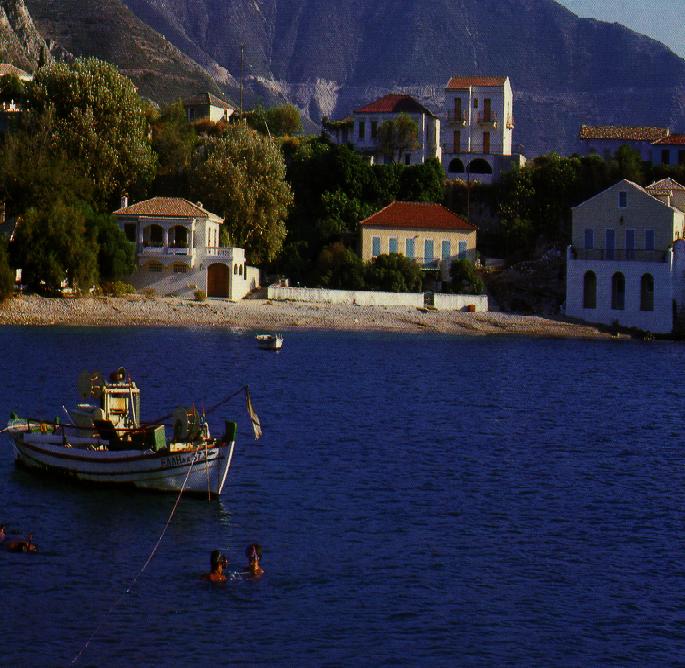
Aghia Eufimia
This is a beautiful, quiet and high quality tourist resort village connected to both the mainland and the island of Ithaca. It offers clear sea and lovely vistas. The monastery of Panagia Theotokos of Themata is at a distance of 10km and offers spectacular views in an unforgettable area.
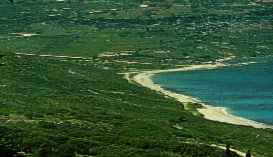
Myrtos
This is a famous beach with crystal clear waters and fine clean sand surrounded by vertical cliffs. It reminds one of sweedish fjords!
Assos (35km)
This is a magnificent village built on a small peninsula with many seal caves ideal for fishing. It is justifiably one of the most beautiful spots on the island. There is a 16th c. citadel built by the venetians to protect against the pirates.
Fiscardo (50km)
It is lovely romantic port village with many interesting places to visit including many coves and green lush areas full of trees. The whole area has been declared a protected area due to its unique beauty and historical importance.
Lixouri
Agricultural area with great natural beauty and substantial historical and archaelogical interests. Although most of it was destroyed in the 1953 earthquake it still boasts many worthwhile churches and relics. It is also known for its musical tradition. Nearby you can visit the interesting "moving rock" (Kounopetra) which is precouriously balanced on underwater foundations allowing to sway.
|